
They are called Surf Barnacles because they prefer to live in areas of medium to high energy wave action.
Small invertebrates that live inside hard circular or pyramid-like structures made from calcium-carbonate. They have eight main side plates, surrounded by many smaller ones, giving them a scaly appearance and are usually grey with a greenish tinge.
Size
20 mm high, 25-30 mm diameter.
Field Guide
Improve your identification skills. Download your Surf Barnacle guide here!

Lowland Leadbeater’s Possum and Helmeted Honeyeater feed on the flowers of this species, which flowers at a different time from the Mountain Swamp Gum. This overlap of flowering time provides food across an extended period for these creatures.
Small to medium tree, 20 m tall. Bark is variable, dark and rough at the butt; upper trunk and branches peel in ribbons.
Leaves
Juvenile leaves are short-stalked, almost circular. Adult leaves are thick, glossy, dark green, ovate shaped, usually has a wavy edge.
Flowers
White cluster of 3 - 10 (often 7).
A dense shrub with pale white peeling, papery bark and numerous branchlets. The Swamp Paperbark grows upto 9m tall and has long needle like leaves.
Leaves
Leaves are arranged alternately, dark green in colour and linear in shape 5-18 mm long and 0.5-1.7 mm wide. Juvenile leaves are typically bright green.
Flowers
Cream/white flowers usually clustered in heads or spikes to 17 mm long and 10 mm wide.
Fruit/Seeds
Small woody loculicidal capsule opening at the summit with 3-4 valves. Woody capsules are typically persistent year round with seed released in pulse events.
Evergreen tree, greyish-brown bark has oak-like appearance, branchlets spreading or drooping. Can be found solo or in dense stands.
Usually 8 – 15 m high. Can reach a maximum of 20 m high (rarely) and only reaches 2 m high on clifftops. The trunk can be up to 35 cm in diameter. This tree is also found in prostrate form (lying flat on the ground), reaching 30 cm high and 2 m wide.
Leaves
Segmented branchlets with very small teeth-like leaves (0.6 - 0.9 mm long), 12 – 17 leaves arise at the nodes of segments. New growth is strongly recurved (bent or curved backwards or downwards) and become erect as they mature.
Flowers
This species is dioecious (male and female reproductive structures develop on different individuals). Male inflorescences (arrangement of flowers) are spikes, growing 1.2 – long with 7 - 10 whorls per cm (ring of floral parts borne at the same level) and a 0.8 mm long anther (pollen-bearing part of the stamen).
Also know as Blackthorn.
A woody shrub to small tree, usually with thorny branches. Grows up to 5 – 10 m high.
Leaves
Glabrous, dark green, 20 – 44 mm long and 5 – 9 –mm wide.
Flowers
White, 6 – 10 mm wide, fragrant.
It was first described by renowned botanist J.E. Smith, the founder of London’s Linneaen Society.
Evergreen shrub with smooth, purplish brown or light green bark. Up to 0.3 – 3 m high.
Leaves
Narrow, straight or very slightly elliptic, and blue-green. Each leaf is about 5 – 15 cm long and 2 – 10 mm wide, with a prominent vein down the centre. Its surface is hairless and covered with a fine white powder. It grows at right angles to the stem.
Flowers
Pale yellow to white and ball-shaped. Each flower is 4 – 7 mm in diameter and is found in clusters of 5 – 10 flowers aligned along an axis of 1 – 3 cm long. They are sweet smelling and enclosed in overlapping bracts (modified leaves) before opening.

Mostly bright green, with a blue crown, cheeks and colouring on its wings. It has red around its bill, throat and forehead, and bright red patches under each wing. The red on its throat is edged with yellow and its long, pointed tail is purple-red. The female is slightly duller, with a creamy bar under its wings.
Size
About 25 cm; ; Wingspan 32 – 36 cm
Large shrub up to 8 m tall.
Leaves
Light green phyllodes (flattened leaf stalks) 14 - 2 0cm long and 2 - 3 cm wide. Several longitudinal veins.
Flowers
Bright yellow flowers arranged forming elongate clusters.
This trail was developed for the Youth Eco Summit at Sydney Olympic Park and will expand in the near future to become a more comprehensive ClimateWatch trail.
Situated on the southern riverside of greater Hobart, Taroona High School is a co-educational school from grades 7 to 10. On the school grounds, this is the first ClimateWatch trail to be created in Tasmania.
The trail falls along the popular Taroona Foreshore Track which offers beautiful views of the Derwent River, crossing the coastline amongst remnant coastal bushland by Hinsby and Taroona beaches. The coastal foreshore and gullies leading into it are cared for by local volunteer groups, the Taroona Environment Network.
The Tegua ClimateWatch Trail, located on Tegua Island in Vanuatu's Torba Province, is a community-led initiative that combines scientific methods with traditional knowledge to monitor climate change impacts. The trail designed to promote environmental stewardship and to be navigable by community members and visitors interested in understanding the effects of climate change on local ecosystems.
he Australian Botanic Garden at Mount Annan hosts remnants of native Cumberland Plain Woodland vegetation. The ClimateWatch trail has been created to engage the public in the long-term monitoring of biodiversity found in the Garden. Mount Annan is also host to the new PlantBank facility which houses the Royal Botanic Gardens Domain & Trust seeds and specialises in scientific research and conservation of native vegetation.
TERN’s Australian SuperSite Network have launched a ClimateWatch trail at Tinaroo Environmental Education Centre (TEEC) - a state government-run centre in far-north Queensland with a 25 year history of providing education on land care, outdoor pursuits and sustainability.
Tom Price is located in the Pilbara region near the Karijini National Park.
30 June 2022 - Bunurong Land Council, Indigital and Earthwatch Australia are proud to launch a new ClimateWatch Cultural Trail experience.
Newhaven College’s beautiful grounds are home to this walking trail experience which celebrates Bunurong stories and nature. From bushfire recovery and resilience, to wisdom about the Moonah tree, powerful narrations from Bunurong Elders enable visitors to understand the importance of country in a new light.
Newhaven College Year 9 and Year 3 students participated in the launch on 23 June, taking the walk around the school grounds. For students, the trail provides an avenue for outdoor classrooms for both environmental and cultural studies. Teacher and ClimateWatch trail manager, Anne Marie McLean, envisions that students will continue to participate in the experience long into the future.
“The ability to share these stories, not just once but indefinitely, will create many opportunities for authentic student learning experiences, helping to forge a deeper connection to country, heritage and the environment,” said Ann Marie, “The knowledge shared will help them to grapple with real world issues and gain a clearer understanding of the land upon which they stand.”
Through innovative augmented reality technology, users simply scan a QR code using the Indigital Storytelling App to see stories come to life with colorful animation and powerful story telling. Powered by Indigital, Australia’s first Indigenous edu-tech company, the trail showcases the creative flair of emerging Bunurong artists and the art and stories of Bunurong Elders.
“It was an absolute privilege to invite Traditional Owners into a safe, respectful space to yarn about their cultural stories and express their thoughts on a range of issues, including climate change, and for them to accept this invitation and be willing to share with us. We introduced the Elders to the technology and explained what we were hoping to achieve through this collaboration, but the real magic happened when they shared. This trail is an example of how technology can connect Elders with young community members and convey 80,000 years of human knowledge for generations to come,” said Cassandra Rowe, Indigital’s Community Connector.
The trail is part of the ClimateWatch program, a national nature monitoring program which empowers everyday citizens to observe the behaviors of our local species. Their photographs and data help researchers understand how flora and fauna are impacted by climate change. In short, citizen science is an avenue for the community to drive positive action on climate change within their local environments.
"The Bunurong people have observed and protected life on Country for over 80,000 years. We have much to learn. I was humbled to be a part of the workshop we held with the Indigital team, Bunurong Elders and Bunurong young people,” says Fiona Sutton Wilson, Earthwatch CEO.
“We came together through our love for nature and its protection. We shared knowledge and developed this Cultural Trail for the ClimateWatch program. ClimateWatch asks citizen scientists to observe nature closely so that we can see the impacts human activity has had on Australia’s plants and animals. This ClimateWatch Cultural Trail creates a new way to learn from and amplify Traditional Owner knowledge and science.”
To read more about the trail, visit www.climatewatch.org.au/trails/victoria/newhaven-college-vic
Earthwatch Australia thanks the Helen Macpherson Smith Trust for supporting the development of an augmented reality Cultural Trail for our ClimateWatch program.
Media Contact: Earthwatch Australia: Tanaya Joshi | This email address is being protected from spambots. You need JavaScript enabled to view it. | 0428 741 445
Bushy shrub or small tree, up to 4m in height.
They can live for over 100 years.
Leaves
Oblong-shaped, usually 1 - 2.5 cm long and 0.5 cm wide.
Flowers
Solitary, white and have circular petals, 8 Usually in groups of 4 - 16 at end of branches. Creamy white in colour.across. Usually appear between December and April.
Upright rounded shrub or small tree that grows 8 - 11 m high although it can be much smaller if it is found in exposed areas. Trunk and branches are grey to dark brown.
Leaves
Lanceolate (lance-shaped) to elliptic (rounded) in shape, measuring 6 – 12 cm in length and 1 - 3.5cm in width. Leaves are leathery to the touch with upper surface of the leaf being a dull green while the underside is pale yellow-green. The margins of the leaf are deeply or shallowly toothed, occasionally entire or sometimes deeply lobed.
Flowers
Flowers may be held in clusters up to 12 cm long. Blooms are white to cream, fragrant and usually abundant when flowering. Flowers are very hairy and spidery in appearance.
The Tyrendarra Indigenous Protected Area (IPA) is managed by the Gundit Mirring Traditional Owners Aboriginal Corporation and the Winda-Marra Aboriginal Corporation.
This ClimateWatch Trail is within a managed IPA, participants must be accompanied by a local indigenous guide. See below for booking information.
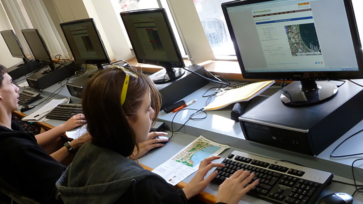
ClimateWatch provides real-world learning opportunities for university students, from data collection out in the field to data analysis and interpretation back in the classroom. By actually making science, not just reading about it, students are engaged and motivated to learn, and feel like they’re making a difference by contributing to Australia’s climate change response.
Tertiary education institutions across the country have been integrating ClimateWatch into their courses and seven Australian universities now have a ClimateWatch trail located on campus. The trails have been developed in collaboration with university teaching staff, grounds staff and local conservation groups who helped select key locations and shortlist ClimateWatch indicator species.
Through delivery partnerships with Australian universities, ClimateWatch is engaging the next generation of scientists, science communicators and computer scientists in projects that make a difference and build Australia’s citizen science capacity. The success of ClimateWatch delivery partnerships relies on creating value for the partner. For example ClimateWatch can involve students from fields as diverse as biology, science communication and computer science through activities like data collection and analysis by science students, representing results can involve software development projects for computer science students and sharing results with non-experts can provide projects for students in science communication.
Digital Volunteer Opportunities
- Participate in hackathon style events, solve data challenges that benefit nature
- Host your own virtual "Data Validation Blitz" using ClimateWatch's community validation feature and the collateral below
Helpful Resources
Case Study | University of Western Australia (UWA)
As part of their course, first-year biology students utilise ClimateWatch records on a chosen species to formulate a hypothesis as to why that species might show different phenophases over time. They are required to submit their own observations, made easy through the dedicated ClimateWatch trail on campus.
Students learn the complete process of scientific research in a fun and engaging way, with research showing the majority planned to continue recording data for ClimateWatch after the project was finished. A large proportion (35 percent) also introduced the application to their friends, demonstrating the important role ClimateWatch has in environmental engagement.
ClimateWatch has been integrating into the biology courses at UWA to help open the eyes of students to what plants and animals are doing at different times of the year, and to demonstrate how this information could be used to better understand the effects of climate change on our biota. It is also contributing to building datasets in Western Australia and first year university students are perfectly positioned to make an important contribution.
This program provides a great opportunity that early year students don't often get to do something that contributes to genuine research. The focus on indicator species introduces students to data gathering with common species such as Willie Wagtails that are frequently seen. Students can practise their observation skills and increase their understanding of animal behaviour in a cumulative fashion. The more they observe, the more they learn, and the more they want to understand about individual species and the impacts that climate change may be having on them.
Explore the ClimateWatch Trail on University of Sydney campus.
On the banks of the Swan River, just minutes from Perth, sits the main campus of the University of Western Australia. An ideal environment to test your ClimateWatch skills and take climate action with our free app.
Urrbrae Wetland is located approximately 6.5 km south of Adelaide. The trail is located at a man-made wetland designed to function as a water retention basin whilst having the benefits of natural wetland characteristics, home to many different species of local plants, providing a productive habitat for numerous species of birds, reptiles, and amphibians.
The Valley Lake Kelta Malpi Conservation Park is located within the Crater Lakes precinct in Mount Gambier featuring picnic facilities, covered shelters, gas barbecues, seating and a playground. The precinct also includes public toilets, extensive parking suitable for buses and access for disabled guests.
Within the 15 ha Valley Reserve, near the corner of Waverley and Stephenson Roads, lies some of the only remaining patches of intact bushland in the area. These provide a vital habitat for a wide range of flora and fauna, and a fascinating insight into how Mount Waverley looked before urban development.